

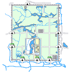
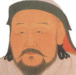


The year is 1290. Kubilai Khan (right) is building his magnificent summer capital, Dadu, - today's Bejing.
The city wall is completed and bold, white-colored gates are already under construction. The city moat is taking shape ...
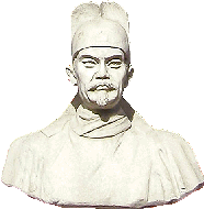
One of his ministers, and a brilliant engineer, Guo Shou Jing (below left), has located a great water source for Kubilai's capital and has constructed Baifu Canal, which carries sufficient water into Dadu. The canal ends at Dadu's harbor, Jishuitan.
But building a capital takes a huge amount of timber, brick, coal and food.
Both building material and food is available in Central- and South China, but not in North China. What to do?
There is of course the famous Imperial Way, running all the way from Canton (today's Guangzhou, just north of Hong Kong) and all the way to a point a mere 17 km east of Kubilai's new capital.
The Grand Canal was originally built in year 605 during the Sui Dynasty (AD 581-618).
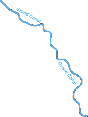
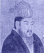
It was a gigantic 2,500 km canal commissioned by Sui emperor Yangdi (604-617) (left). Joining up with the Southern river systems at Hangzhou it formed the Imperial Way. It was capable of transporting commodities and food all the way from Guangzhou to Tongxian, some 17 km east of Beijing (right).
Kubilai Khan redredged the old Sui canal and escavated a new section between the Yellow River and the Yangtze River, shortening the length to some 1,800 km.
As something new he also had the embankments reinforced with stones to prevent the earth from giving way.
But it was still costly and inefficient to transport goods over land all the way from Tongxian to Beijing. A solution was badly needed.
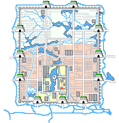
Kubilai again called upon his "super" engineer, Guo Shou Jing, to construct "the missing link", the Tonghui Canal.
The connection started at the southern end of Jishuitan running south along the eastern end of the Imperial Palace in today's Beiheyan and Nanheyan.
The water passed under the southern city wall and followed today's Zhengyi Road until turning east along today's Qianmen Street.
It then flowed 17 km in the newly escavated Tonghui Canal all the way to Tongxian.
It joined up with Wenyu River, a major North-South local river system, which turned into the Grand Canal south of Tonghui Canal.
Because of the topography, Guo Shou Jing had to construct some 24 lock gates to regulate water levels. Would the grain barges put up with that?
An overflow canal flowed eastward from Jishuitan and emptied into Ba River, which again flowed gently into Wenyu River north of Tongxian.
It is very likely that many grain barges prefered to use the steady flow of Bahe rather than having to negotiate the 24 lock gates of Tonghui Canal.
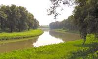
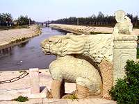
Ba River remains a wide river (picture) though the overflow role passed to the northern Qing River.
In the subsequent Ming dynasty (1368-1644), the northern city wall was moved south so that Bahe now flowed directly into the new northern moat at the northeastern city wall corner tower.
However, has mission now been accomplished?
By 1293, Kublai Khan with the aid of his engineer, Guo Shou Jing, had indeed solved the task of securing an efficient and economic flow of commodities and grain into his new, thriving summer capital of Dadu.
The capital could now be finished. The best craftsmen ensured that the Imperial Palace was fit for an emperor ruling the largest expanse of territory ever -then and now.
The gates and city moat were completed. Large warehouses were located close to the gates inside the city gates.
The area around the Imperial Palace was surrounded by the famous Hutongs. The northern areas inside the city walls were left as hunting grounds for the Khan's mongols.